Geophysica Vol. 56, Nos. 1–2, 2021
Abstract
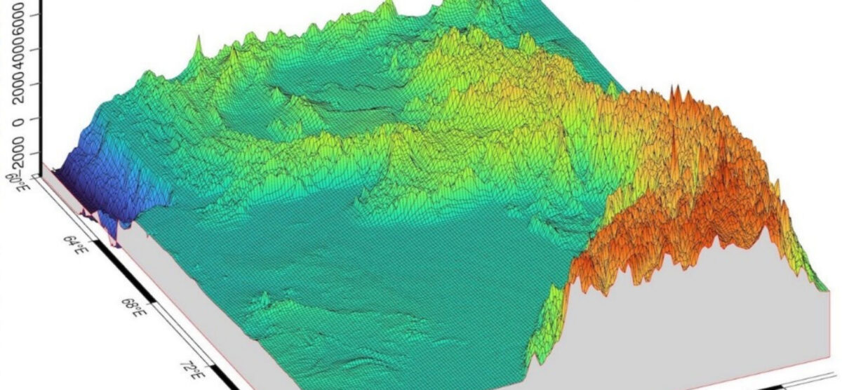
Along with the development of the scripting technology in cartography, such as the Generic Mapping Tools (GMT) and libraries of R programming language, geologic and geophysical mapping is being vigorously promoted, where the integration of the thematic data, such as GEBCO/SRTM, EGM-2008 and open geological raster and vector layers is one of the primary datasets that provides the highresolution raw sources for cartographic visualization in the geologically complex regions like Pakistan. This study aims to integrate scripting methods of automated cartography, methods of applied geoinformatics for geomorphometric analysis and technical data processing (formatting, projecting, plotting), to provide a synthesis of the geological, geophysical and geomorphological maps of Pakistan they as new information supporting analysis of the geospatial variations of geology, geomorphology, tectonics and gravity fields with a special focus on the geologically remarkable region of Pakistan: Sulaiman Fold Belt and Muslim Bagh ophiolite complex. This study presents new 12 thematic maps, which are technically made using scripting approaches and open tools. All maps cover the region of Pakistan and they are made using open source tools: GMT, R and QGIS. A GMT and R based scripting mapping is applied for mapping Pakistan, and its algorithm steps are presented stepwise as code snippets. A system complex approach of the data integration and formats reshaping, data conversion and reformatting for a single project of the geology of Pakistan is designed and developed based on the combination of the programming and scripting techniques and with additional QGIS based mapping, which effectively integrates the thematic geospatial multi-origin datasets. Various color palettes and cartographic visualization approaches have been used to achieve the best visualization. The resulting maps are explained and discussed. Correlation between spatial phenomena of Earth’s gravity, geologic evolution and tectonic movements were pointed out and commented on. New 12 maps present the regional geologic setting of the country.